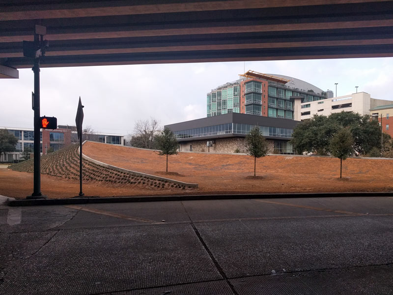
Some of the intermediate developmental stages of the pointy new hill between the Pierce Elevated and the old Mr. Peeples spot raised a few questions in the mind of a nearby reader (chief among them: whether the Midtown Redevelopment Authority was constructing an ark.) A few photos from last week (including the top shot above) showed what appear to be wooden forms heralding the pouring of a concrete landscaping wall. A set of new shots from this morning paint a more complete picture of the site, showing a cargo of several new trees now settled in place in the gentle concave curve behind the structured hill’s prow (as seen in the second shot above). Beyond the wall, the other side of the mound appears to have been dotted with ornamental grass: Here’s the same angle from early last week: And here’s a head-on before-and-after shot of the hill, facing north along Brazos St. — the older shot shows some ridges that look to have been since smoothed over, while the newest layer of earth applied to the spot is still dotted with footprints: Previously on Swamplot: Work Crews Creating Actual Hill by the I-45 Exit Ramp Behind Mr. Peeple’s Old Spot; In Search of the Elusive Midtown Boundary, at the W. Gray and Webster Split Photos: rol_tec … Read More


